🗺️ Google Maps Directions
The Wolverine Peak Trail is a true gem of Southcentral Alaska, offering 360° views of the surrounding landscape, including the majestic Denali on clear days. As a seasoned hiker, I can attest that this trail is not for the faint of heart, but the rewards are well worth the effort. The summit, standing tall at 4,455 feet, is one of the best high-altitude day hikes in the region, and the scenery is nothing short of breathtaking. From the lush green valleys to the rugged mountain peaks, this trail has it all. As you hike, keep an eye out for the unique rock formations, shaped by the relentless forces of nature, and the vibrant wildflowers that dot the landscape.
Getting There & Parking
To access the Wolverine Peak Trail, head to the Prospect Heights Trailhead, located at the end of Prospect Heights Road, off O’Malley Road. From Anchorage, take O’Malley Road east and turn left onto Prospect Heights Road. The trailhead parking area is approximately 1.5 miles down the road, and it’s free to park. Be aware that the parking area can fill up quickly, especially on weekends, so it’s a good idea to arrive early. Additionally, be mindful of the private property signs and respect the landowners’ rights. The trailhead is well-marked, and the sign indicates the start of the Wolverine Peak Trail.
Trail Description
The Wolverine Peak Trail begins with a gentle climb through a lush forest, following a well-maintained dirt path. As you ascend, the trees give way to scrubby bushes and eventually, rocky terrain. The trail is well-marked, but it’s essential to pay attention to the signs and cairns, as the route can be confusing in some areas. At around the 2-mile mark, you’ll reach a small stream crossing, which can be tricky to navigate, especially during high water. After the crossing, the trail begins to steepen, and the climb becomes more intense. The final push to the summit is a grueling ascent up a rocky slope, but the views from the top are well worth the effort. On the descent, be careful not to miss the turnoff for the trail, as it’s easy to get caught up in the stunning views and lose track of the route.
What You’ll See
The Wolverine Peak Trail offers some of the most spectacular views in Southcentral Alaska. From the summit, you can see Denali, the highest peak in North America, on clear days. The surrounding landscape is a tapestry of rugged mountains, glaciers, and valleys, with the occasional glimpse of a moose or Dall sheep. The trail passes through a variety of ecosystems, including forests, tundras, and rocky outcroppings, each with its unique set of flora and fauna. Keep an eye out for the vibrant wildflowers, including lupines, gentians, and forget-me-nots, which add a splash of color to the landscape. As you hike, you’ll also notice the unique rock formations, shaped by the forces of glaciation and weathering.
What Locals Say
⚠️ Don’t Make This Mistake
Bear Safety on This Trail
The Wolverine Peak Trail passes through areas with known brown bear activity, and it’s essential to take necessary precautions. Hikers should carry bear spray and know how to use it properly. Make noise while hiking to avoid surprise encounters, and stay alert for signs of bears, including tracks, scat, and digging. The most likely areas for bear encounters are the lower valleys and stream crossings, where bears tend to congregate.
What to Bring
To ensure a safe and enjoyable hike on the Wolverine Peak Trail, bring the following essential gear: hiking boots, trekking poles, water filter, bear spray, and first aid kit. Don’t forget to pack plenty of water, snacks, and layers, as the weather can be unpredictable.
FAQ
Q: What is the best time to hike the Wolverine Peak Trail?
A: The best time to hike the Wolverine Peak Trail is from late June to September, when the weather is generally warmer and drier.
Q: Are dogs allowed on the trail?
A: Yes, dogs are allowed on the trail, but they must be kept on a leash.
Q: How long does it take to complete the hike?
A: The hike typically takes 7-10 hours to complete, depending on your pace and the amount of time you spend at the summit. For more information on trails in the area, check out our guides to the Flattop Mountain Trail, Little O’Malley Peak, and Rabbit Lake.
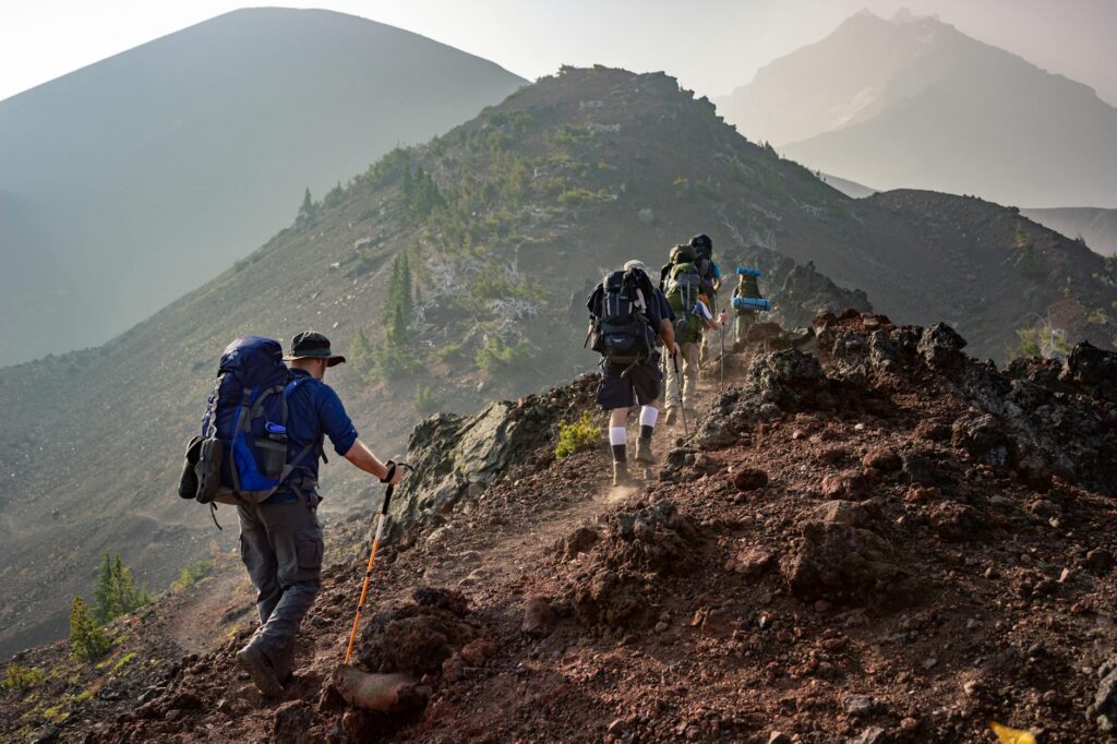
Views along Wolverine Peak Trail, Prospect Heights Trailhead, Anchorage
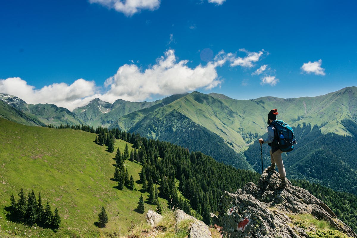
The reward: 360° views including Denali on clear days
🗺️ Related Trails You’ll Love
Chugach State Park ↗