
Byron Glacier — Complete Anchorage Trail Guide 2026
\n
Trail Overview
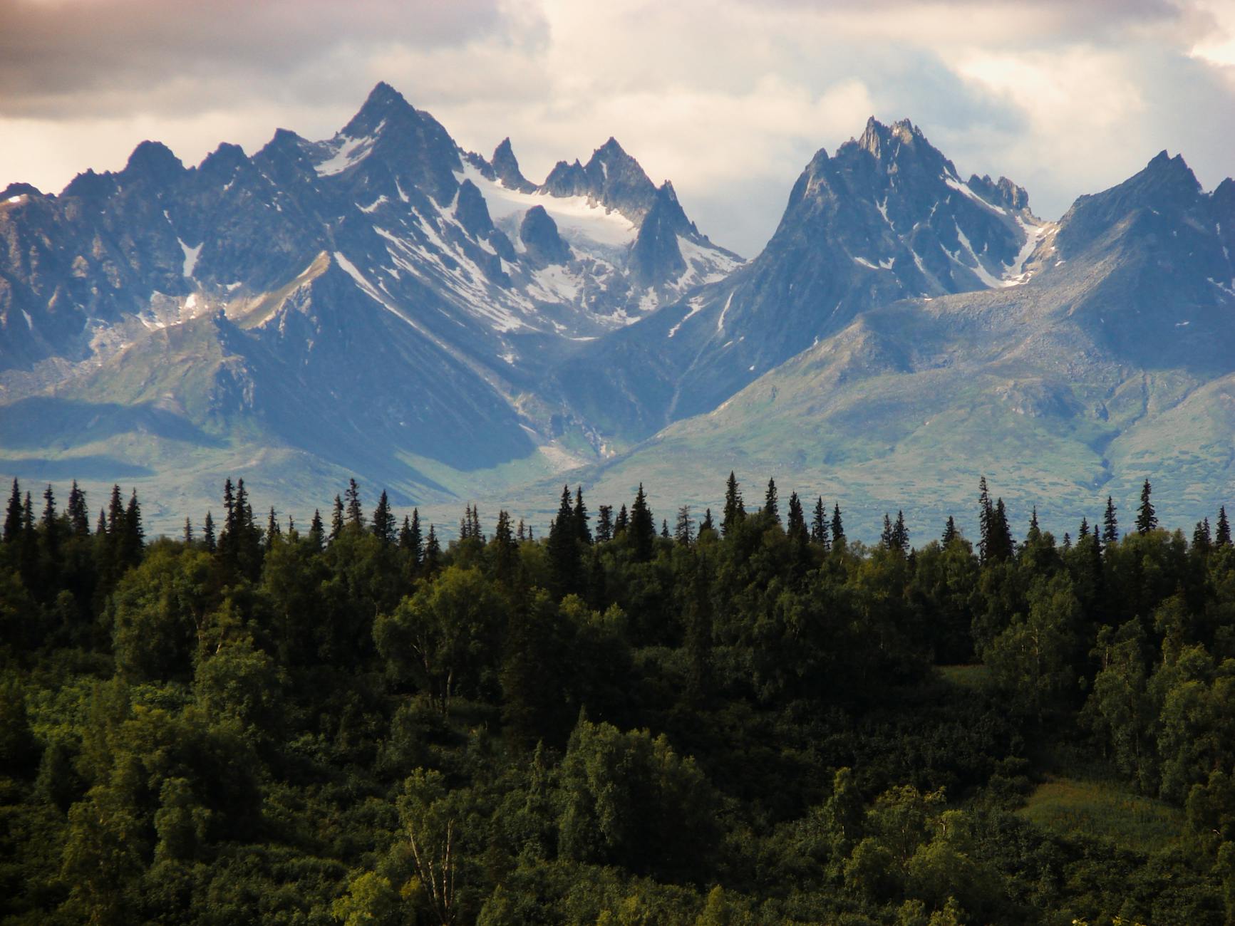
Byron Glacier is a must-do hike for anyone visiting Anchorage, and as a local, I can attest to its unique charm. This easy, 3-mile round-trip trail is perfect for families, beginners, or those looking for a quick escape from the city. What makes Byron Glacier special is its accessibility and stunning views – you’ll be standing in front of a breathtaking glacier in no time. As you hike, keep an eye out for the surrounding mountains, which offer a glimpse into the region’s rich geological history. With its well-maintained trail and minimal elevation gain, Byron Glacier is an ideal introduction to Alaska’s natural beauty.
One of the reasons I love Byron Glacier is its versatility – it’s a great hike for any time of year, depending on your preferences. In the summer, the trail is lined with wildflowers and the glacier is at its most accessible. In the winter, the trail is a popular spot for snowshoeing and cross-country skiing. As a local, I’ve had the pleasure of watching the glacier change over the years, and I can tell you that it’s a truly unique experience.
Whether you’re a seasoned hiker or just starting out, Byron Glacier is a great choice. The trail is well-marked, and the scenery is breathtaking. So, grab your hiking boots and get ready to experience one of Anchorage’s most stunning natural attractions.
Trail History
The area surrounding Byron Glacier has a rich and diverse history, dating back to the Dena’ina Athabascan indigenous people who first inhabited the region. The Dena’ina people considered the surrounding mountains and glaciers to be sacred, and they would often travel to the area for spiritual and subsistence purposes. In the late 18th century, Russian explorers arrived in the area, followed by American explorers and settlers. The trail to Byron Glacier was likely established during this period, although it wasn’t formally developed until the mid-20th century.
Geologically, the area is a result of the last ice age, which carved out the surrounding mountains and created the glacier. The glacier itself is a remnant of this period, and it’s been slowly retreating over the years. Notable events in the area include the 1964 earthquake, which caused significant changes to the glacier’s shape and size. Today, the trail is managed by the Chugach National Forest, and it’s a popular destination for hikers and outdoor enthusiasts.
Trail Description — Step by Step
The trail to Byron Glacier begins at the Byron Glacier Trailhead, located at the end of the Portage Glacier Road. From the parking lot, follow the well-marked trail as it winds its way through a lush forest of spruce and hemlock trees. At 0.5 miles, you’ll reach a small clearing with a sign marking the entrance to the Chugach National Forest. Continue on the trail as it begins to climb gently, offering stunning views of the surrounding mountains. At 1 mile, you’ll reach a fork in the trail – take the left fork, which leads to the glacier.
As you continue on the trail, keep an eye out for the unique rock formations and wildflowers that line the path. At 1.5 miles, you’ll reach a small stream crossing, which can be icy in the early season. Be sure to use caution when crossing, and consider bringing trekking poles if you’re unsure. Once you’ve crossed the stream, the trail begins to climb more steeply, offering breathtaking views of the glacier. At 2 miles, you’ll reach the glacier’s toe, where you can take in the stunning scenery and snap some photos.
One of the best photo spots is at the 2.2-mile mark, where you can capture the glacier’s unique shape and color. Be sure to stay behind the safety ropes, as the glacier can be unstable and prone to calving. As you make your way back down the trail, take note of the unique geological formations and the stunning views of the surrounding mountains.
🗣 What Locals Say
“No one was hurt — snow on trail by the little bridge. [After the large avalanche at Byron Glacier.] Always stay on the marked trail and be aware of overhead hazards.”
“Glad everyone is safe! Nice job catching it on video! Byron Glacier is stunning but the terrain reminds you that Alaska’s mountains are always active.”
“I hate to tell you, but that’s not the glacier — it’s residual snow from last year’s avalanches. Those snow caves are also dangerous. The glacier itself has receded significantly.”
Wildlife & Seasonal Conditions
Byron Glacier is home to a variety of wildlife, including moose, bears, and eagles. Be sure to keep an eye out for these animals, especially during the fall season when they’re more active. The trail is generally snow-free from May to October, although it can be icy in the early season. Be sure to check the current conditions before heading out, and consider bringing crampons or ice axes if you’re unsure. You can check the current conditions on the Chugach National Forest website.
What to Bring
* Hiking boots or sturdy shoes
* Trekking poles (optional)
* Bear spray
* Water and snacks
* Sunscreen and insect repellent
* Camera and extra batteries
* Map and compass (and/or GPS device)
* America the Beautiful/Interagency Pass or day fee
* Dogs are allowed on-leash, so be sure to bring poop bags and keep your furry friend under control.
Trail stats: Difficulty: Easy, Distance: 3 miles round-trip, Elevation: 200 ft gain, Time: 1.5 hours, Dogs: Yes, on-leash, Permit: America the Beautiful/Interagency Pass or day fee, Best Season: May–October
📸 Trail Photos

💬 What Locals Say
“Park early on summer weekends — trailhead lots fill by 9am. Arrive before 7:30am for guaranteed parking.”
“Bring microspikes for shoulder seasons (May and September). The trail can be icy even when it looks clear.”
“The best photo spot is about 2/3 of the way up — you get Anchorage skyline and Cook Inlet in the same frame.”
“This is bear country. Make noise, carry bear spray, hike in groups. Bears are most active at dawn and dusk.”
🗺️ Map & Directions
📍 GPS & Navigation
Coordinates: 60.7880°N, 148.8850°W
Trailhead: Byron Glacier Trailhead
Directions: From Anchorage, take Seward Hwy south ~50 miles to Portage Glacier Rd. Follow signs to Byron Glacier parking lot, 1 mile past the Begich, Boggs Visitor Center.
🥾 Nearby Trails
Official Trail Info: Chugach National Forest — USFS ↗